Natural heritage
A great diversity that stands as the perfect setting to enjoy the experience you are looking for
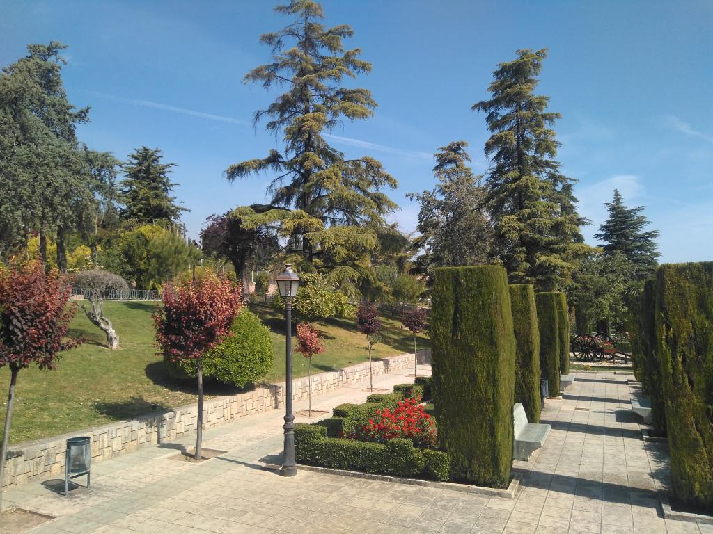
Manuel Carrasco Park
Natural and recreational space divided into three floors and inaugurated in 1974. It is the main park of the city and symbolizes the expansion of the current Martos. As it appears in a monolithic, its name is due to a former mayor of Martos, at whose time the Municipal Park was built.
Among its infrastructures it has numerous cultural and leisure facilities, such as the Children's Park where the Monument to the Olive Growers is located, the Municipal Theater "Maestro Álvarez Alonso", the Fairgrounds and the Pilar de la Fuente Nueva.
Address: Pierre Cibié Avenue.
Viboras Reservoir
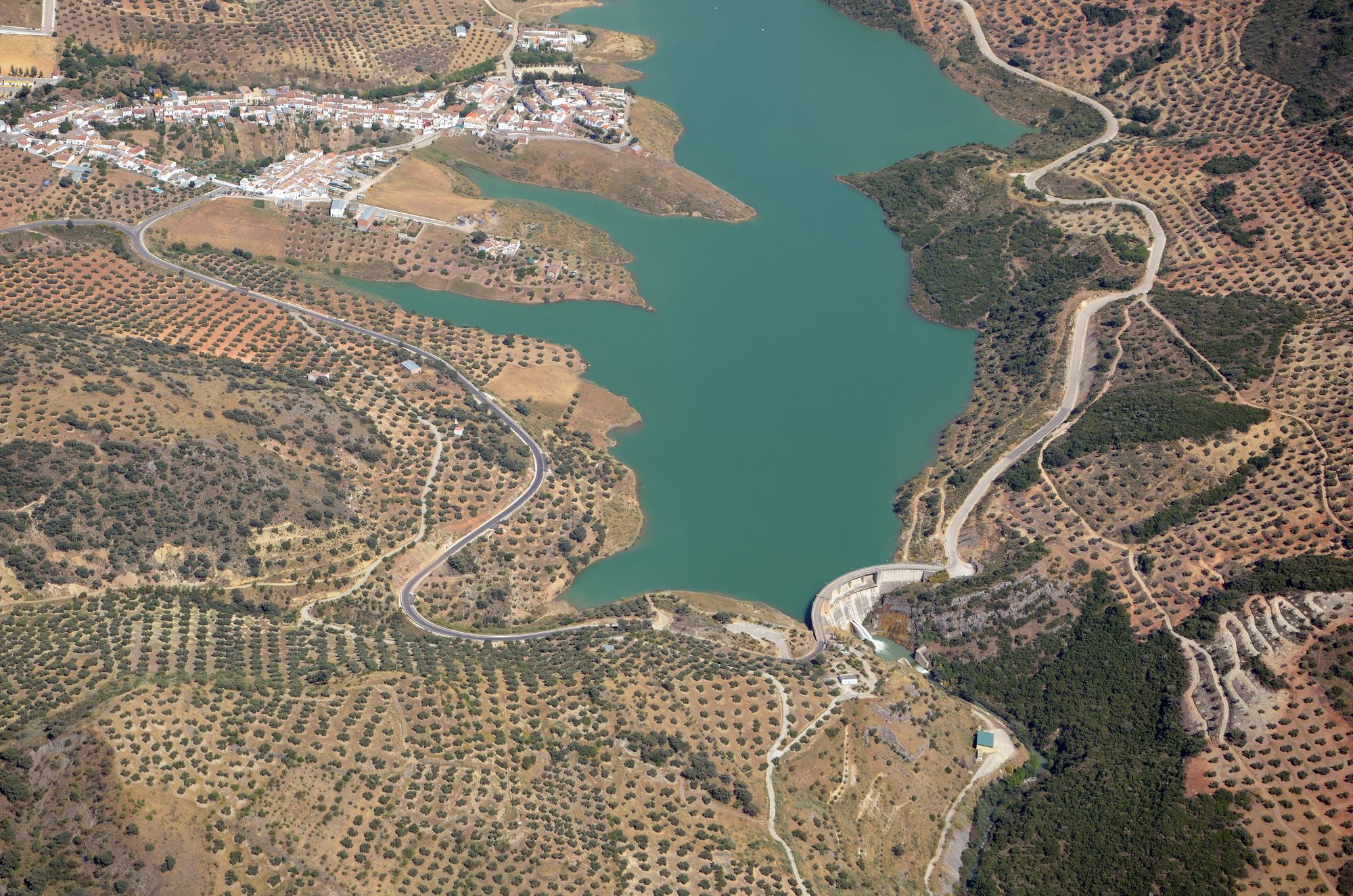
Reservoir built in 1997 in the district of Las Casillas, it is located in the bed of the Viboras River, between the Sierra de la Grana and the Sierra Caracolera. It was built for supply and as an ecological flow.
It is surrounded by vegetation, olive groves for the most part, occasional pine forests and Mediterranean mountains.
In the reservoir you can find a very varied classification of fish that places it as a place where sport fishing is practiced, even holding contests on its shores.
Address: Las Casillas, Martos.
Hituelo Lagoon
Natural lagoon that is part of the Guadalquivir hydrographic basin. It is located between the term of Martos and Higuera de Calatrava, very close to El Cortijo El Madroño. It is surrounded by vegetation, constituting an ideal habitat for flora and fauna, in which there are some species in danger of extinction, such as the Moorish Coot and an important population of flamingos.
Address: Leaving Martos on the J-2130 in the direction of Higuera de Calatrava and after traveling about 11 km, we will turn right onto a private lane that leads to this enclave.
Address: Monte Lope Álvarez, Martos.
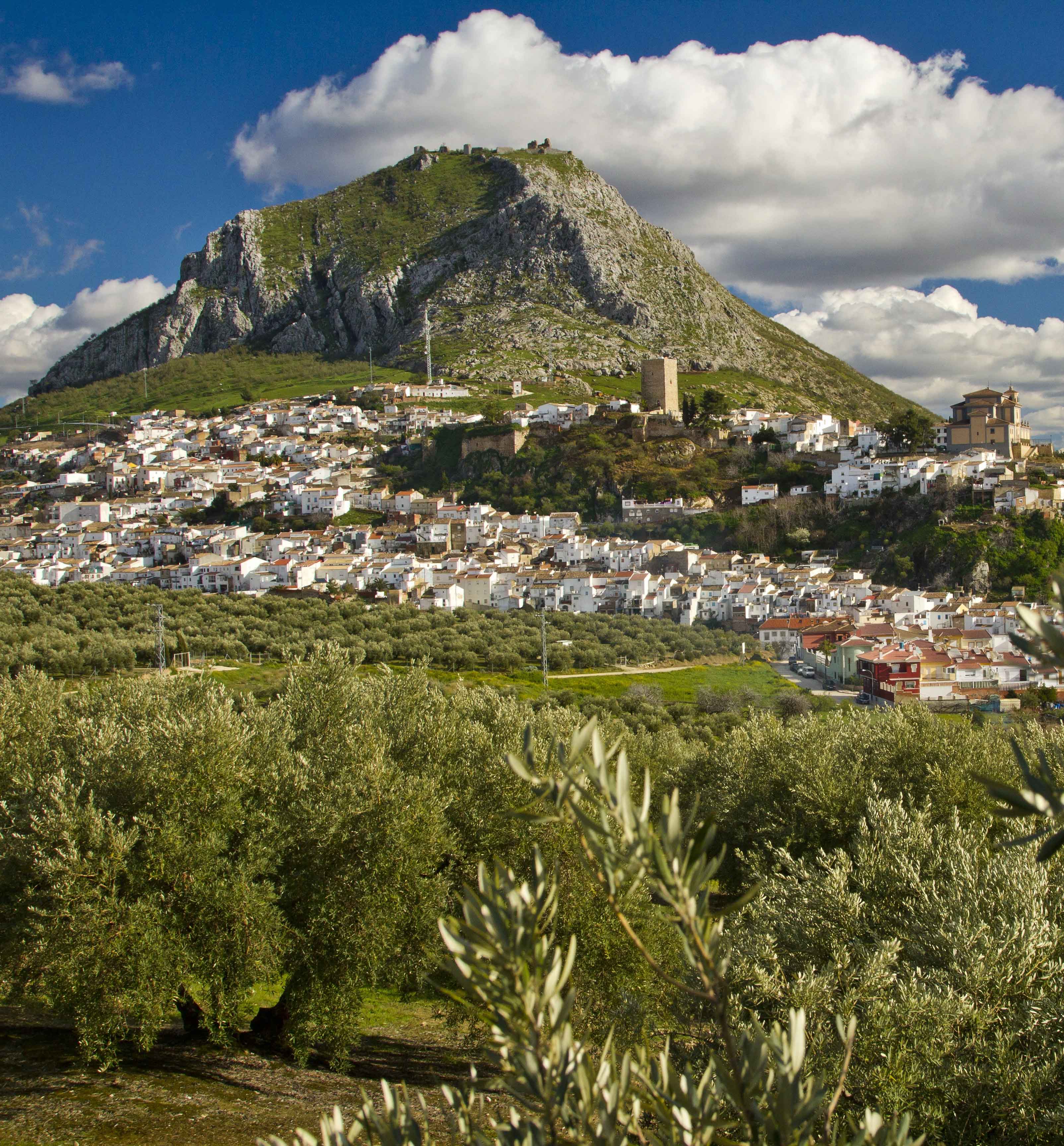
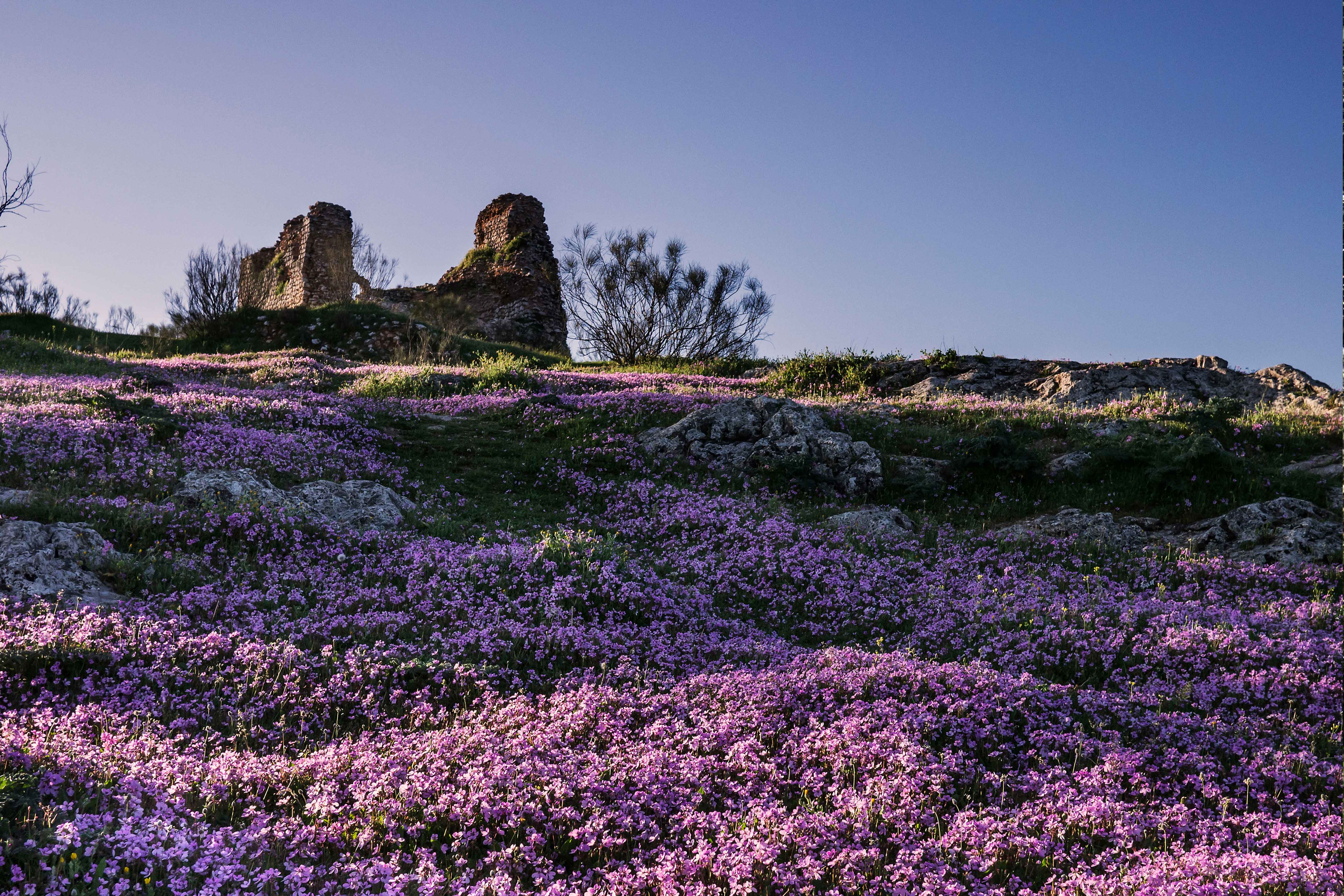
The grief
The most representative natural resource in the city. It has an area of more than 31,000 square meters and its top reaches 1,003 meters above sea level.
At the top are the remains of the Fortaleza Alta or Castillo de la Peña, as well as extraordinary views of the landscape of the countryside and the surrounding mountains.
We can access through Calle Molino Medel or Callejón Puerta del Sol to the Hermitage of the Virgen de la Victoria.
From this point, the climb can only be continued on foot to the summit, whose distance does not exceed 20 minutes.
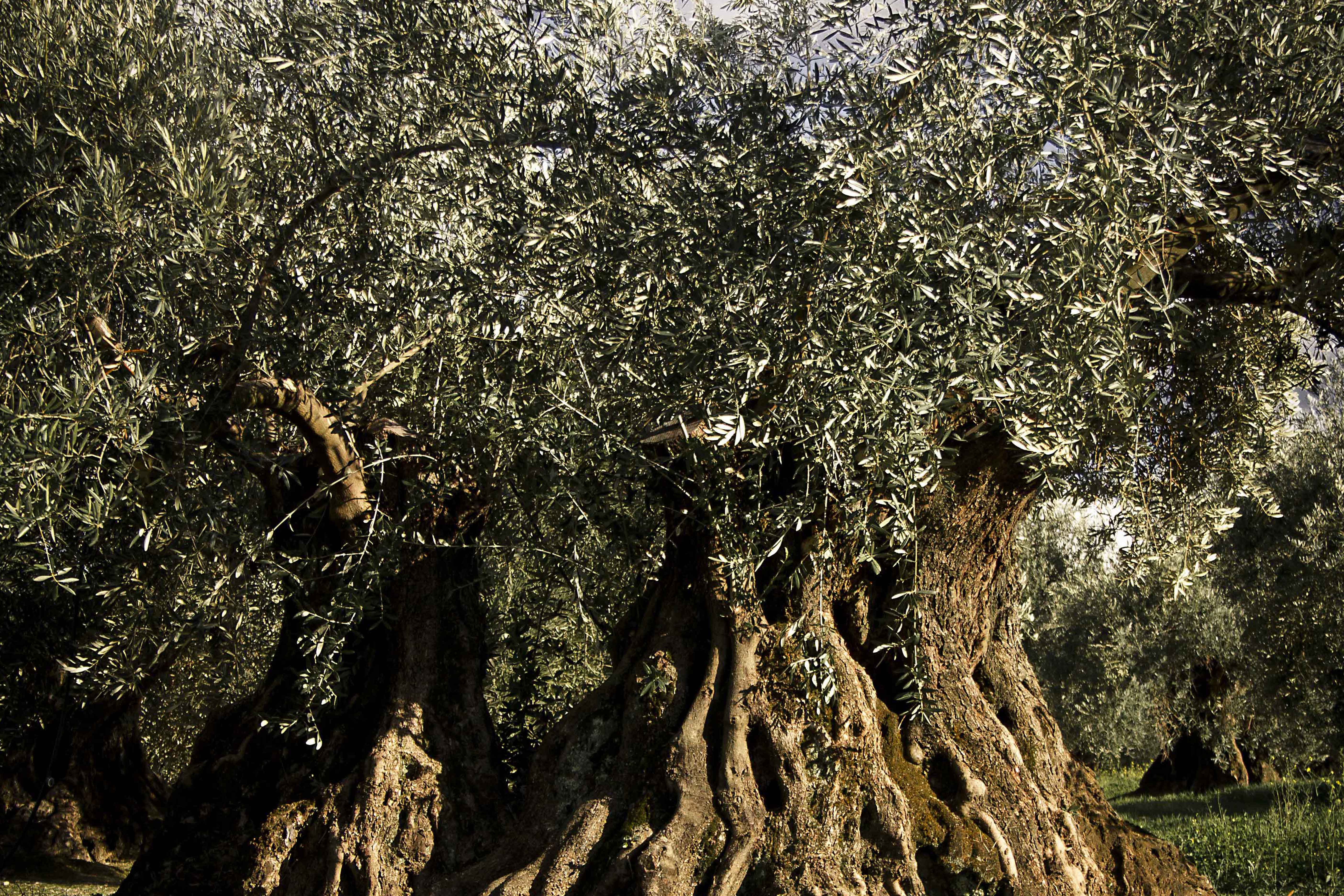
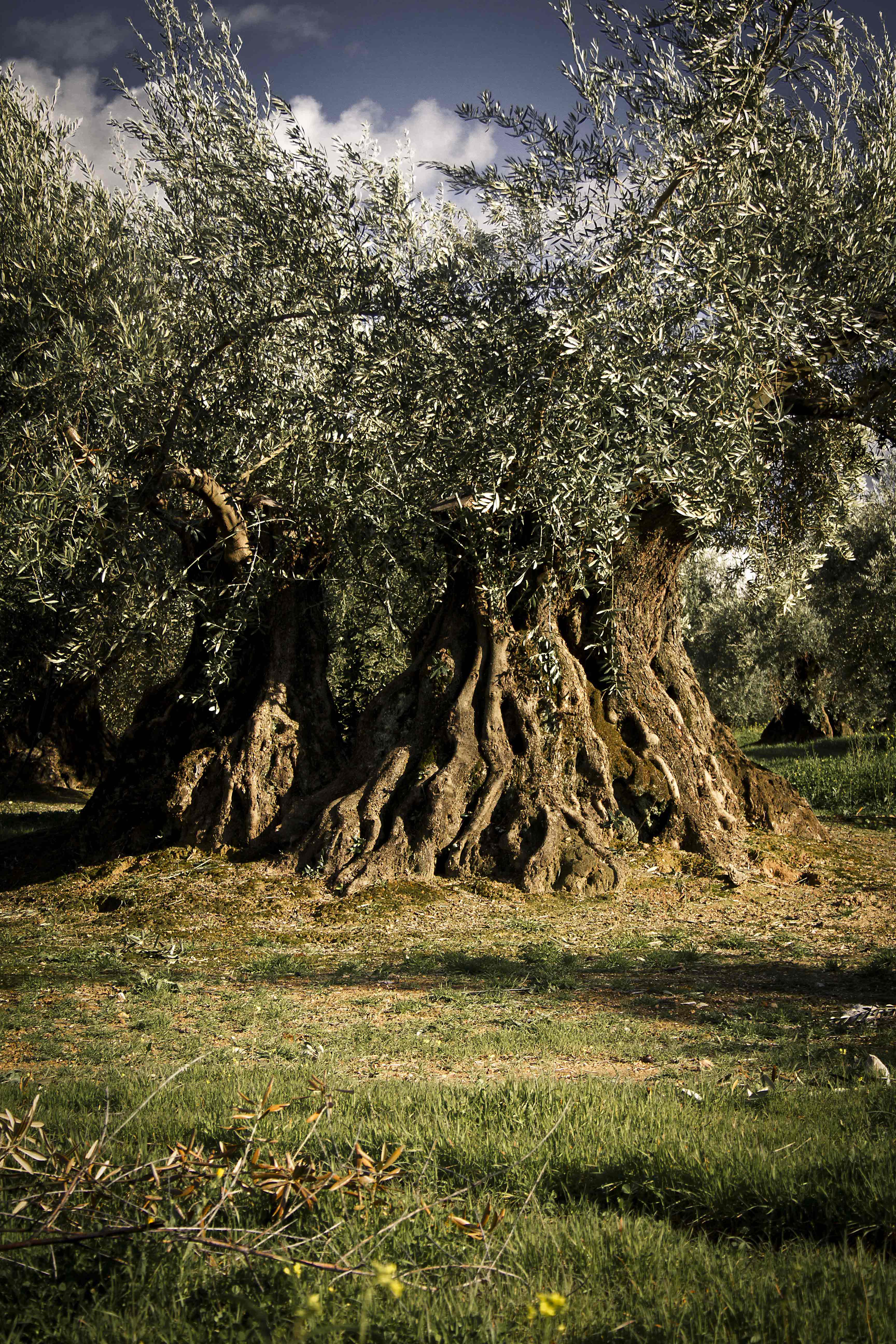
Centennial olive trees of the Llano de Motril
Set of olive trees that have witnessed the history of the city for more than 100 years. Most of them are over 500 years old, and they are found in a place called the Llano de Motril, just over 1km from the urban center.
This natural resource, mythical tree of our region, is appreciated for the majesty of its leafy trunks, some of which are true living sculptures.
Its great productivity is striking, considering its age.
Address: Highway J – 213 in the direction of Santiago de Calatrava, taking the first lane to the right after passing the Lamarca Ecological Orujera.
Sierra de la Grana
The Sierra de la Grana forms one of the last foothills of Sierra Mágina, in the Subbético massif, to the north of Sierra Nevada.
The Sierra appears dotted with threshing floors, huts, goatherds and albarradas that help form small fertile terraces, all of them expressions of the work culture of earlier times.
Through it run the Eliche River, the Fuente de la Villa Stream, the Maleza Stream and the Las Mulas Stream.
It reaches a height of 1,253 meters above sea level.
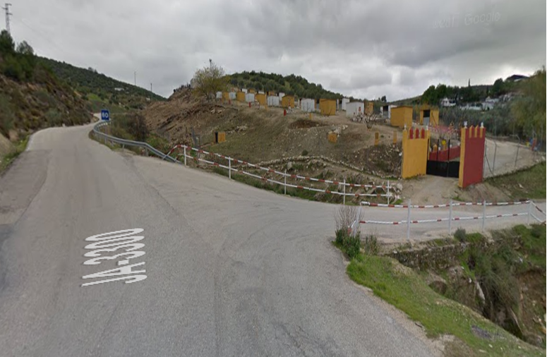
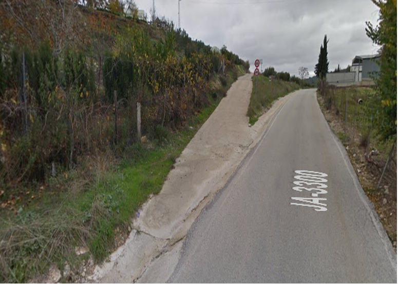
Address: You can access the Sierra de la Grana by car via the JA-3300, after passing the intersection of the Fuente del Caño stream (Image 1).
Taking the second lane to the left (image 2).
Snail Siera
Sierra belonging to the Sierra Sur de Jaén, which separates the terms of Martos and Alcaudete.
It has a great diversity of flora among which holm oaks, pine forests and kermes oaks dotted with strawberry trees and brooms take center stage. The olive grove reaches almost to the top of the mountain range.
From the summit you can see the municipalities of Martos, Las Casillas, La Carrasca, Fuensanta de Martos, La Bobadilla, Torredonjimeno, Castillo de Locubín, Ventas del Carrizal, Alcaudete, Luque, Priego de Córdoba.
It reaches a height of 1,325 meters above sea level.
Direction:
Green Way of Oil
Road infrastructure that runs through the area of Jaén, Torredelcampo, Torredonjimeno, Martos and Alcaudete, taking advantage of the route of the old and dismantled Jaén-Campo Real railway line.
This line mainly transported oil, which is why the train was known as the "Oil Train", although it was also used to move people.
Some of the characteristics of the road are the number of tunnels, footbridges and iron bridges it crosses, of great architectural and landscape value as well as the diversity of flora and fauna of the Jaén countryside.
Likewise, from the capital to the end of the route, you can enjoy historical monuments such as the Jaén Cathedral, the Arab Baths, Temples and Castles, Archaeological Sites, etc.
This route continues in the province of Córdoba as the Vía Verde de la Subbética, with a total length of 128 kilometers from Jaén to Puente Genil.